One of the aims of the CARIOQA-PMP project is to use earth observation from space to improve the monitoring of climate events. Although the sensors developed within CARIOQA-PMP will be a technological breakthrough, earth observation from space to monitor climate change effect like droughts, floods, fires… is already an existing operational method.
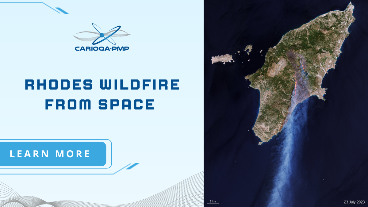
Wildfires burning on the Greek island of Rhodes this summer have forced the evacuation of thousands of people as flames spread from the island’s mountainous region to the coast. In response to the fires, the Copernicus Emergency Mapping Service was activated. Satellite observations are used to help civil protection authorities and the international humanitarian community respond to emergencies, in case of disasters.
The image processed by combining natural colour bands with shortwave infrared information shows the extent of the burnt area (visible in shades of brown) in the central part of the island, with a preliminary estimation of 11 000 hectares lost at the time of acquisition.
Learn more about the role of the sentinel-2 mission in the fire monitoring
